


DTM Digital Terrain Model


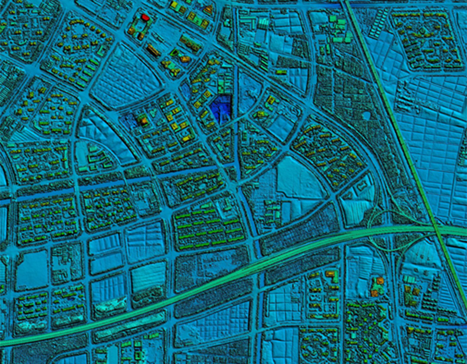
DTMDigital Terrain Model
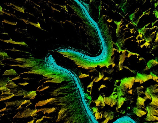
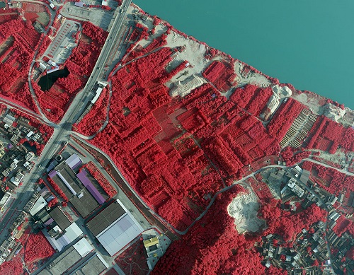
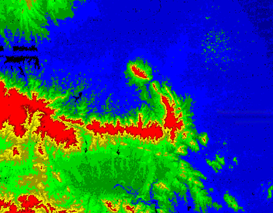
DTM Digital Terrain Modelis a digital elevation model in which terrain data has been further enhanced with breaklines, creating greater accuracy as it contains additional information defining terrain in areas where Lidar data alone is unable to do the job effectively.
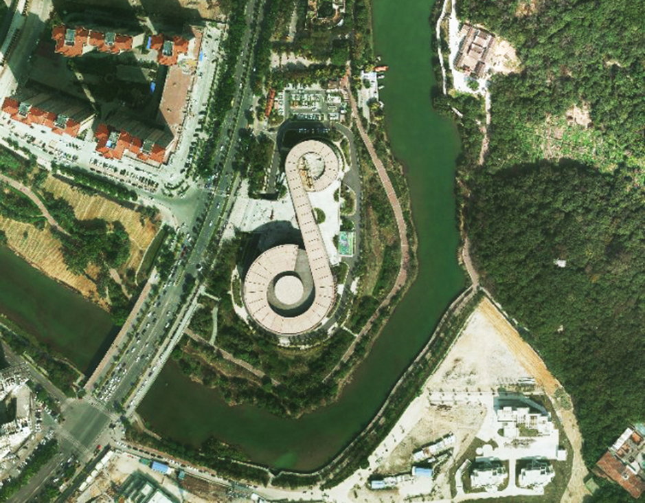
Terrain models are based on point clouds obtained during airborne laser scanning. A Digital Terrain Model (DTM) is a true representation of the terrain relief. When we supplement it with extra information about objects on the surface, we can create a Digital Surface Model (DSM). Being a universal tool, terrain models can be used for determining slope and elevation, but also for identification of landforms and discovery or inventory of archaeological objects.
Feiyan Technologyalso generates fully detailedDTMDigital Terrain Model for contour generation, orthophoto rectification, and flood plain mapping.
Specification ofDTMDigital Terrain Model
Resolution: ≥2 points/m²
Project area: 31,934 km²
Duration: 1 month
Output: DSM,DEM,classified point clouds
Application: forestry planning
Accuracy: ≥98%
Grid spacing: 2m
From: Guangxi Forestry Bureau
Отправить запрос, связаться с поставщиком
Другие товары поставщика
 |
Orthophoto | Orthophoto Feiyan Technologyspecialises in high-resolution orthophoto map production including digital orthophotos and orthophoto mosaics from raw... |
 |
DEM Digital Elevation Model | DEM Digital Elevation Model DEM digital elevation model is a 3D representation of the terrain elevations found on surface of the earth. DEMs are g... |
 |
Color Infrared aerial photography | Color Infrared aerial photography Color Infrared aerial photography can not only be used to document changes to the environment, the health of for... |
|
|
DTM Digital Terrain Model | DTMDigital Terrain Model DTM Digital Terrain Modelis a digital elevation model in which terrain data has been further enhanced with breaklines, cr... |
 |
LIDAR | LIDAR Laser scanning allows spatial measurements thanks to capturing of a laser beam reflection. This method gives us information on the structure... |
Похожие товары
 |
Sphincterotomes | Продавец: MICRO-TECH (Nanjing) Co., Ltd | Performance Characteristics Tapered tip Monofilament cutting wire KEY BENEFITS Tapered ti... |
 |
KRC-YPBOX Commercial Audio Player | Продавец: Kerchan Technology Co., Ltd | Up to 6 audio devices (speaker, headset, soundbar, subwoofer etc.). LED lighting/LED panel con... |
 |
HJT Solar Cell | Продавец: Anhui Huasun Energy Co., Ltd | What Is HJTSolar Cell? Huasun hjt solar cell technologywas made of ultra-thin N-type silicon waf... |
|
|
Color Infrared aerial photography | Продавец: Feiyan Aerial Remote Sensing Tech Co., Ltd | Color Infrared aerial photography Color Infrared aerial photography can not only be used to docu... |
 |
3D Mapping Service | Продавец: Feiyan Aerial Remote Sensing Tech Co., Ltd | 3D Mapping Service Resolution: 5cm Project area: 220km² Duration: 11 months Output: 3D m... |


