

GREENBELT SATELLITE REMOTE SENSING


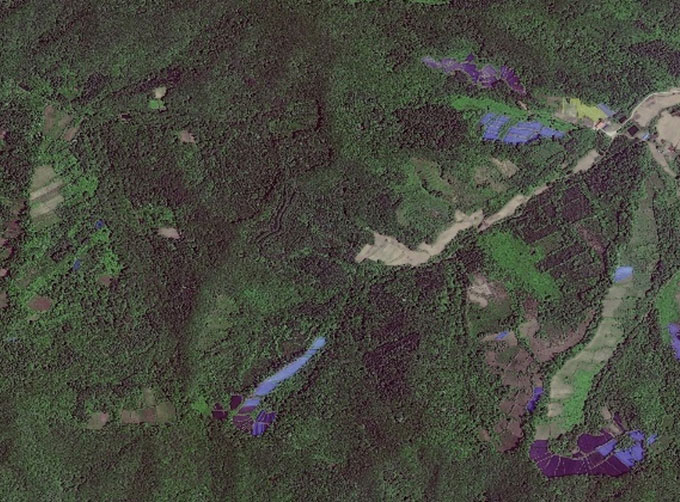
Greenbelt grass remote sensingis a technology that is used to detect and analyze the type distribution and biomass of grassland resources.
Jilin satellitefounded on December 1st, 2014, it's a unique commercial aerospace enterprise with the development and operation of satellite research, management as well as remote sensing information processing all in one. With a total registered capital of 1.97 billion RMB, the company comprises Jilin Provincial Government, Changchun Institute of Optics, Fine Mechanics and Physics (CIOMP), social capital, and technical backbone.
As one of satellite service providers, we will do our best to meet all the needs of customers.
Отправить запрос, связаться с поставщиком
Другие товары поставщика
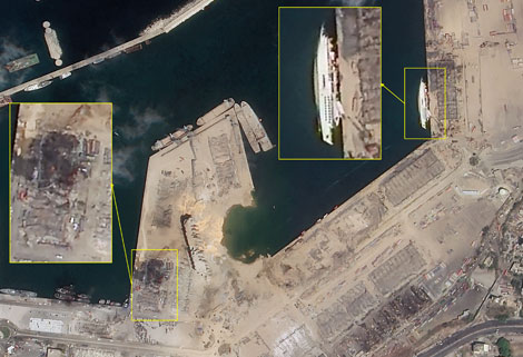 |
SATELLITE IMAGE MONITORING | Change remote sensing monitoringuses multi-temporal remote sensing data, a variety of image processing and pattern recognition methods to extract c... |
 |
NIGHT SATELLITE IMAGE | The SP and GF03C satellites of JL1 constellection can conduct fast shooting with high-resolutions and multispectrums at night, which can reflect hu... |
 |
SATELLITE REMOTE SENSING IN AGRICULTURE | SATELLITE REMOTE SENSING IN AGRICULTURE Agricultural remote sensing refers to the comprehensive technology of agricultural applications such as us... |
 |
CUSTOMIZED SATELLITE TESTING SERVICE | Custom Satellite Solutions Jilin satellitecan provide customized remote-sensing information services to meet your specific needs. FEATURES OF CUS... |
 |
MULTI SPECTRAL IMAGERY | Multispectral Image Data The GP satellites of JL1 constellection have 26 spectral channels, covering optical remote sensing data from visible ligh... |
Похожие товары
 |
PHOTOGRAMMETRY REMOTE SENSING | Продавец: Chang Guang Satellite Technology Co., Ltd. | Photogrammetry remote sensingis to obtain reliable information about the earth, its environment a... |
 |
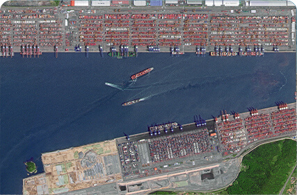
MARINE REMOTE SENSING | Продавец: Chang Guang Satellite Technology Co., Ltd. | MARINE REMOTE SENSING Ocean colour remote sensingrefers to remote sensing that takes the ocean a... |
|
|
NIGHT SATELLITE IMAGE | Продавец: Chang Guang Satellite Technology Co., Ltd. | The SP and GF03C satellites of JL1 constellection can conduct fast shooting with high-resolutions... |
 |
MULTISPECTRAL IMAGES IN REMOTE SENSING | Продавец: Chang Guang Satellite Technology Co., Ltd. | Multispectral remote sensing refers to the multispectral data remote sensingtechnology that divid... |
 |
MULTI SPECTRAL IMAGERY | Продавец: Chang Guang Satellite Technology Co., Ltd. | The GP satellites of JL1 constellection have 26 spectral channels, covering optical remote sensin... |
