
GREENBELT SATELLITE REMOTE SENSING


Greenbelt grass remote sensingis a technology that is used to detect and analyze the type distribution and biomass of grassland resources.
Jilin satellitefounded on December 1st, 2014, it's a unique commercial aerospace enterprise with the development and operation of satellite research, management as well as remote sensing information processing all in one. With a total registered capital of 1.97 billion RMB, the company comprises Jilin Provincial Government, Changchun Institute of Optics, Fine Mechanics and Physics (CIOMP), social capital, and technical backbone.
As one of satellite service providers, we will do our best to meet all the needs of customers.
在线联系供应商
Other supplier products
 |
MULTISPECTRAL IMAGES IN REMOTE SENSING | Multispectral remote sensing refers to the multispectral data remote sensingtechnology that divides the electromagnetic wave radiated by ground obj... |
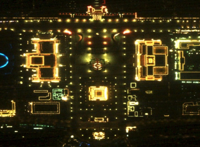 |
NIGHT SATELLITE IMAGE | Satellite View of Earth at Night The SP and GF03C satellites of JL1 constellection can conduct fast shooting with high-resolutions and multispectr... |
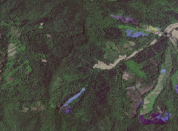 |
GREENBELT SATELLITE REMOTE SENSING | grass remote sensingis a technology that is used to detect and analyze the type distribution and biomass of grassland resources. Changguang, as ... |
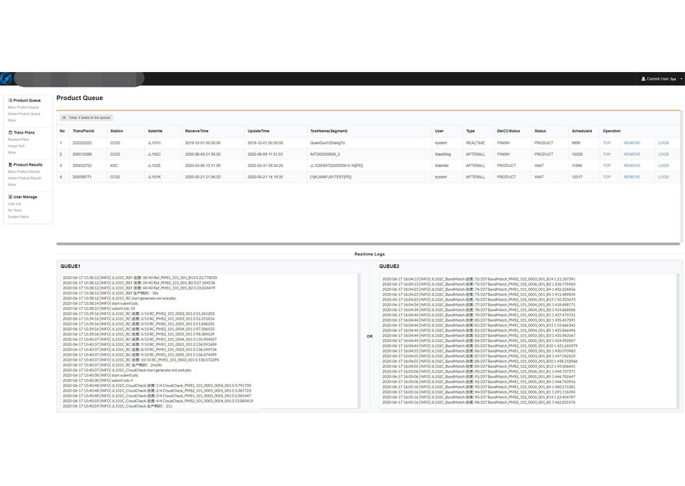 |
SATELLITE IMAGE PROCESSING TECHNIQUES | SATELLITE IMAGE PROCESSING TECHNIQUES SATELLITE IMAGE ACQUISITION SYSTEM SATELLITE IMAGES FOR IMAGE PROCESSINGFEATURES 1 Satellite image pr... |
 |
MULTISPECTRAL IMAGES IN REMOTE SENSING | Multispectral Remote Sensing Applications hyperspectral and multispectral remote sensingrefers to the remote sensing technology that divides the e... |
Same products
 |
PHOTOGRAMMETRY REMOTE SENSING | 卖方: Chang Guang Satellite Technology Co., Ltd. | Photogrammetry remote sensingis to obtain reliable information about the earth, its environment a... |
 |
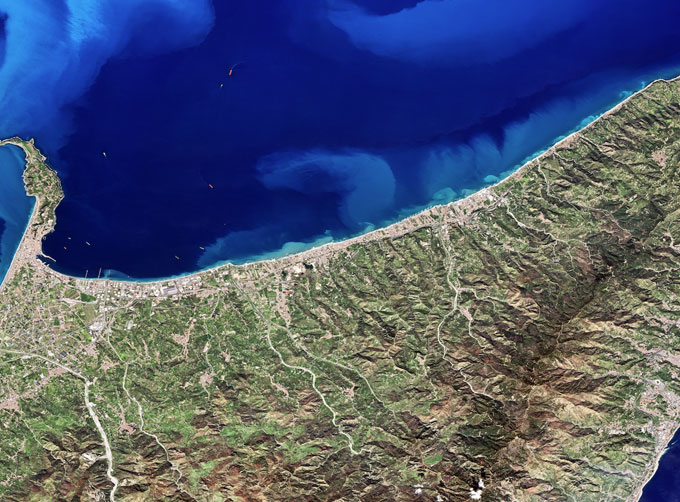
MARINE REMOTE SENSING | 卖方: Chang Guang Satellite Technology Co., Ltd. | MARINE REMOTE SENSING Ocean colour remote sensingrefers to remote sensing that takes the ocean a... |
 |
NIGHT SATELLITE IMAGE | 卖方: Chang Guang Satellite Technology Co., Ltd. | The SP and GF03C satellites of JL1 constellection can conduct fast shooting with high-resolutions... |
|
|
MULTISPECTRAL IMAGES IN REMOTE SENSING | 卖方: Chang Guang Satellite Technology Co., Ltd. | Multispectral remote sensing refers to the multispectral data remote sensingtechnology that divid... |
 |
MULTI SPECTRAL IMAGERY | 卖方: Chang Guang Satellite Technology Co., Ltd. | The GP satellites of JL1 constellection have 26 spectral channels, covering optical remote sensin... |
