

MULTISPECTRAL IMAGES IN REMOTE SENSING


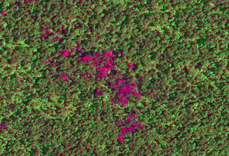
Multispectral remote sensing refers to the multispectral data remote sensingtechnology that divides the electromagnetic wave radiated by ground objects into several narrow spectral bands and obtains the information of the same target in different bands at the same time by photographing or scanning.
Chang Guang Satellite Technology Co., Ltd. is a satellite company, we provide satellite china, multispectral and hyperspectral remote sensing, multispectral remote sensing, hyperspectral and multispectral remote sensing, multi spectral remote sensing, satellite data products,etc. Formore informationabout multispectral remote sensing applications, please feel free to contact us!
Отправить запрос, связаться с поставщиком
Другие товары поставщика
 |
SATELLITE IMAGE MONITORING | Change remote sensing monitoringuses multi-temporal remote sensing data, a variety of image processing and pattern recognition methods to extract c... |
 |
MARINE REMOTE SENSING | Oceanographic Applications of Remote Sensing Ocean color remote sensing refers to remote sensing that takes the ocean and coastal zone as the moni... |
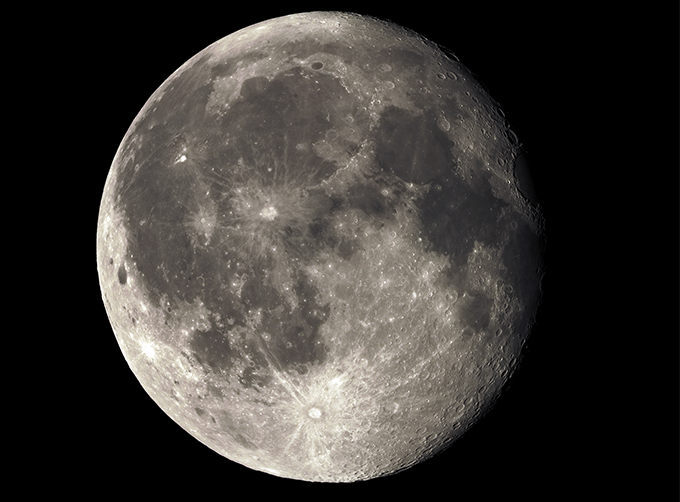 |
LUNAR SATELLITE IMAGES | Jilin 1satellites can not only capture the images of the earth, but they can also turn the cameras to photograph space objects, such as the space s... |
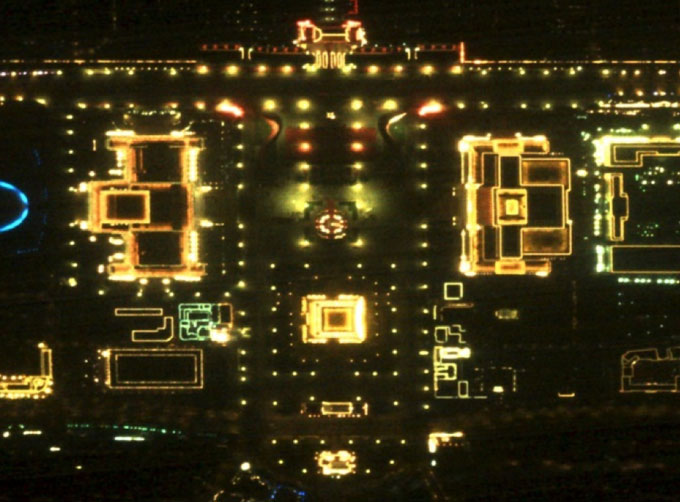 |
NIGHT SATELLITE IMAGE | Satellite View of Earth at Night The SP and GF03C satellites of JL1 constellection can conduct fast shooting with high-resolutions and multispectr... |
 |
Satellite Remote Sensing | Satellite Remote Sensing Remote sensing is a non-contact, long-distance detection technology. Relying on the unique global data set of JL1, using ... |
Похожие товары
 |
PHOTOGRAMMETRY REMOTE SENSING | Продавец: Chang Guang Satellite Technology Co., Ltd. | Photogrammetry remote sensingis to obtain reliable information about the earth, its environment a... |
 |
MARINE REMOTE SENSING | Продавец: Chang Guang Satellite Technology Co., Ltd. | MARINE REMOTE SENSING Ocean colour remote sensingrefers to remote sensing that takes the ocean a... |
 |
NIGHT SATELLITE IMAGE | Продавец: Chang Guang Satellite Technology Co., Ltd. | The SP and GF03C satellites of JL1 constellection can conduct fast shooting with high-resolutions... |
|
|
MULTISPECTRAL IMAGES IN REMOTE SENSING | Продавец: Chang Guang Satellite Technology Co., Ltd. | Multispectral remote sensing refers to the multispectral data remote sensingtechnology that divid... |
 |
MULTI SPECTRAL IMAGERY | Продавец: Chang Guang Satellite Technology Co., Ltd. | The GP satellites of JL1 constellection have 26 spectral channels, covering optical remote sensin... |

