

PHOTOGRAMMETRY REMOTE SENSING


Photogrammetry remote sensingis to obtain reliable information about the earth, its environment and other natural objects and processes by using satellite imaging technology and then analyze and express the obtained data.
Chang Guang Satellite Technology Co., Ltd. is a satellite manufacturers, we provide photogrammetry and remote sensing, remote sensing and photogrammetry, satellite communication service, etc. Formore information, please feel free to contact us!
Отправить запрос, связаться с поставщиком
Другие товары поставщика
 |
NIGHT SATELLITE IMAGE | The SP and GF03C satellites of JL1 constellection can conduct fast shooting with high-resolutions and multispectrums at night, which can reflect hu... |
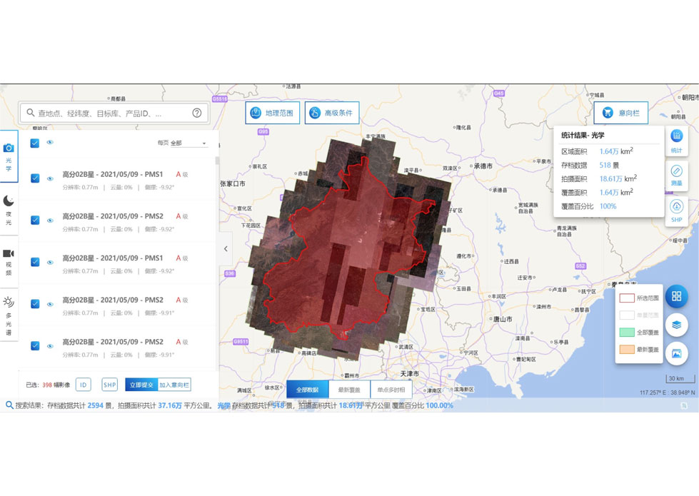 |
SATELLITE DATA MANAGEMENT | DATA MANAGEMENT SYSTEM SATELLITE DATA MANAGEMENT FEATURES 1 The data management system is the center of the storage, management and applicatio... |
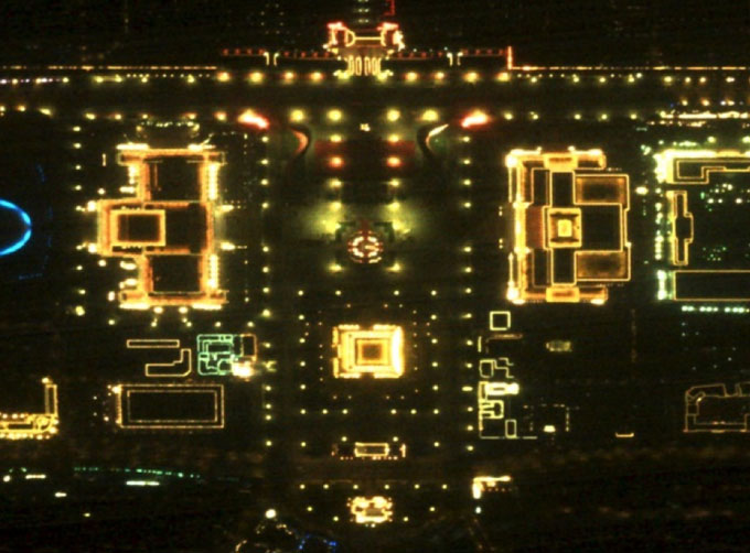 |
NIGHT SATELLITE IMAGE | Satellite View of Earth at Night The SP and GF03C satellites of JL1 constellection can conduct fast shooting with high-resolutions and multispectr... |
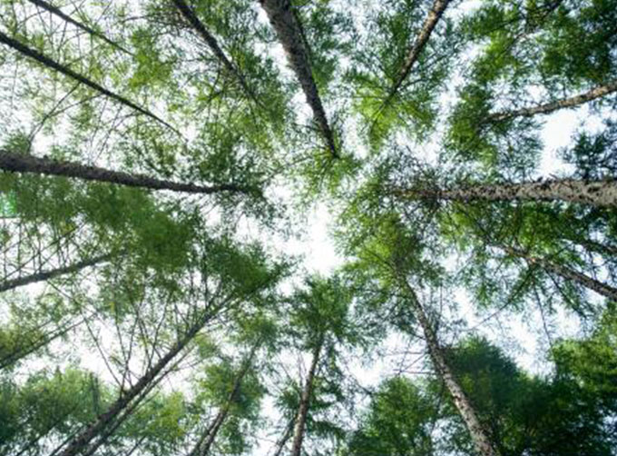 |
REMOTE SENSING IN FORESTRY | Remote sensing in forestryis a technology that uses the inherent characteristics of electromagnetic waves reflected or radiated by objects to ident... |
 |
CUSTOMIZED SATELLITE TESTING SERVICE | Custom Satellite Solutions Jilin satellitecan provide customized remote-sensing information services to meet your specific needs. FEATURES OF CUS... |
Похожие товары
|
|
PHOTOGRAMMETRY REMOTE SENSING | Продавец: Chang Guang Satellite Technology Co., Ltd. | Photogrammetry remote sensingis to obtain reliable information about the earth, its environment a... |
 |
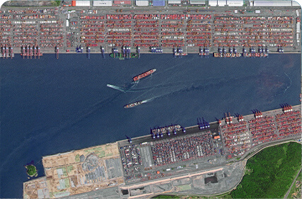
MARINE REMOTE SENSING | Продавец: Chang Guang Satellite Technology Co., Ltd. | MARINE REMOTE SENSING Ocean colour remote sensingrefers to remote sensing that takes the ocean a... |
|
|
NIGHT SATELLITE IMAGE | Продавец: Chang Guang Satellite Technology Co., Ltd. | The SP and GF03C satellites of JL1 constellection can conduct fast shooting with high-resolutions... |
 |
MULTISPECTRAL IMAGES IN REMOTE SENSING | Продавец: Chang Guang Satellite Technology Co., Ltd. | Multispectral remote sensing refers to the multispectral data remote sensingtechnology that divid... |
 |
MULTI SPECTRAL IMAGERY | Продавец: Chang Guang Satellite Technology Co., Ltd. | The GP satellites of JL1 constellection have 26 spectral channels, covering optical remote sensin... |

