
MARINE REMOTE SENSING


Oceanographic Applications of Remote Sensing
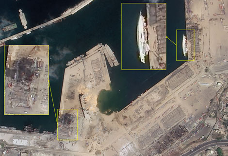
Ocean color remote sensing refers to remote sensing that takes the ocean and coastal zone as the monitoring and research object, including physical oceanography
satellite remote sensing, biological oceanography and chemical remote sensing oceanography. Ocean remote sensing uses sensors to carry out long-distance non-contact observation of the ocean to obtain images or data of the marine landscape and marine elements.
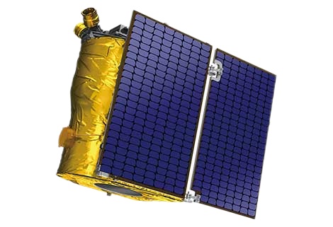
Jilin 1 satelliteconstellation is the core project under construction by CGSTL. The first phase of the project consists of 138 high-performance optical remote sensing satellites covering video, high resolution, wide band, infrared, multispectral and other series.
在线联系供应商
Other supplier products
 |
Satellite Hardware | The satellite communication hardwares of CGSTL mainly consist of satellite products, CubeSat platform, satellite cameras, standalone products, and ... |
 |
SATELLITE IMAGE MONITORING | Change remote sensing monitoringuses multi-temporal remote sensing data, a variety of image processing and pattern recognition methods to extract c... |
 |
INSURANCE SATELLITE REMOTE SENSING | Combining satellite remote sensing technologies with rights confirmation data and land parcel segmentation technology can vectorize and spatialize ... |
 |
REMOTE SENSING IN ENVIRONMENT | remote sensing in environmentis a general term for monitoring, evaluating and forecasting the dynamic changes of the natural and social environment... |
 |
REMOTE SENSING IN FORESTRY | Remote sensing in forestryis a technology that uses the inherent characteristics of electromagnetic waves reflected or radiated by objects to ident... |
Same products
 |
PHOTOGRAMMETRY REMOTE SENSING | 卖方: Chang Guang Satellite Technology Co., Ltd. | Photogrammetry remote sensingis to obtain reliable information about the earth, its environment a... |
 |
MARINE REMOTE SENSING | 卖方: Chang Guang Satellite Technology Co., Ltd. | MARINE REMOTE SENSING Ocean colour remote sensingrefers to remote sensing that takes the ocean a... |
 |
NIGHT SATELLITE IMAGE | 卖方: Chang Guang Satellite Technology Co., Ltd. | The SP and GF03C satellites of JL1 constellection can conduct fast shooting with high-resolutions... |
 |
MULTISPECTRAL IMAGES IN REMOTE SENSING | 卖方: Chang Guang Satellite Technology Co., Ltd. | Multispectral remote sensing refers to the multispectral data remote sensingtechnology that divid... |
 |
MULTI SPECTRAL IMAGERY | 卖方: Chang Guang Satellite Technology Co., Ltd. | The GP satellites of JL1 constellection have 26 spectral channels, covering optical remote sensin... |
