
PHOTOGRAMMETRY REMOTE SENSING


Photogrammetry remote sensingis to obtain reliable information about the earth, its environment and other natural objects and processes by using satellite imaging technology and then analyze and express the obtained data.
Chang Guang Satellite Technology Co., Ltd. is a satellite manufacturers, we provide photogrammetry and remote sensing, remote sensing and photogrammetry, satellite communication service, etc. Formore information, please feel free to contact us!
在线联系供应商
Other supplier products
 |
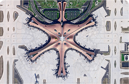
Satellites Data Service | At present, JL1 constellation has 72 on-orbit satellites in space and more than 5,000,000 square kilometers of new shooting area in the world are a... |
 |
SATELLITE CAMERAS | Satellite Cameras Specialized devices that take high-quality images from space. 5m-resolution Multispectral Camera 2m-resolution Micro-nano Came... |
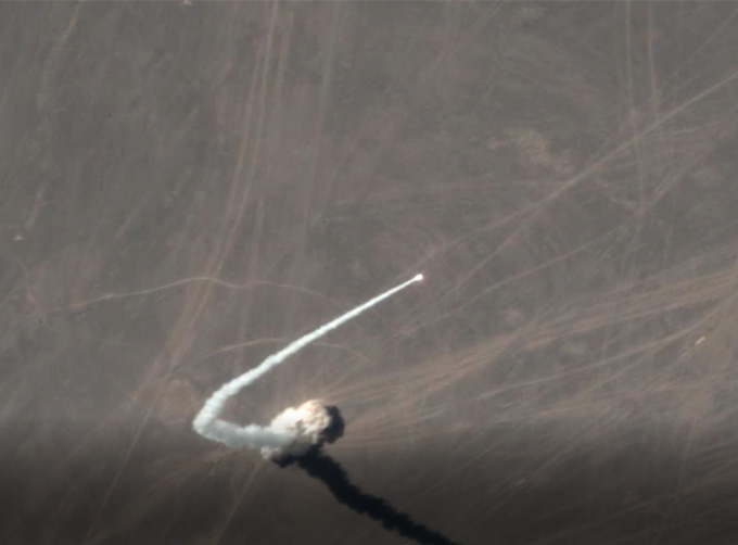 |
SATELLITE IMAGE VIDEO | Satellite Image Video The SP, GF03C and MF satellites of JL1 constellection can gaze at a single target point for 120 seconds at most to record ... |
 |
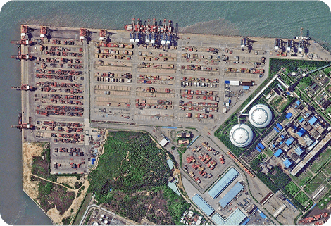
SATELLITE IMAGE MONITORING | Change remote sensing monitoringuses multi-temporal remote sensing data, a variety of image processing and pattern recognition methods to extract c... |
 |
SATELLITE REMOTE SENSING IN AGRICULTURE | SATELLITE REMOTE SENSING IN AGRICULTURE Agricultural remote sensing refers to the comprehensive technology of agricultural applications such as us... |
Same products
|
|
PHOTOGRAMMETRY REMOTE SENSING | 卖方: Chang Guang Satellite Technology Co., Ltd. | Photogrammetry remote sensingis to obtain reliable information about the earth, its environment a... |
 |
MARINE REMOTE SENSING | 卖方: Chang Guang Satellite Technology Co., Ltd. | MARINE REMOTE SENSING Ocean colour remote sensingrefers to remote sensing that takes the ocean a... |
 |
NIGHT SATELLITE IMAGE | 卖方: Chang Guang Satellite Technology Co., Ltd. | The SP and GF03C satellites of JL1 constellection can conduct fast shooting with high-resolutions... |
 |
MULTISPECTRAL IMAGES IN REMOTE SENSING | 卖方: Chang Guang Satellite Technology Co., Ltd. | Multispectral remote sensing refers to the multispectral data remote sensingtechnology that divid... |
 |
MULTI SPECTRAL IMAGERY | 卖方: Chang Guang Satellite Technology Co., Ltd. | The GP satellites of JL1 constellection have 26 spectral channels, covering optical remote sensin... |
