
Satellites Testing Services

The satellite communication testing services of CGSTL mainly consist of optical manufacture, satellite testing, and customized service.
CHANGGUANG JL1 SATELLITE ENVIRONMENTAL TESTING TO GET YOU ON BOARD
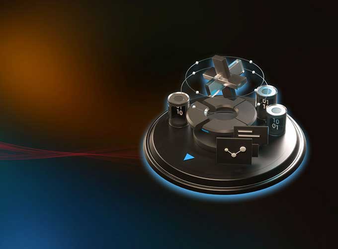
High Technology Maturity
CGSTL has a high level of technical maturity and rich experience in satellite communication testing and can provide many types of test simulation services, such as satellite testing and satellite vibration testing, etc.
EXPLORE JL1 TESTING SERVICES SOLUTIONS
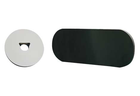
Component-level Thermal-vacuum Test
Used to simulate complex environments, such as vacuum and heat, etc., and check the reliability of satellite environmental testing. And it can also be used to measurement of stress relief, degassing, and dehumidification, etc.
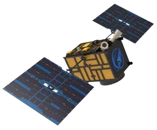
Space Camera / Satellite Vacuum Heat Experiment
Used to simulate the vacuum, thermal and other space environment in which cameras/satellites work in orbit, conduct system inspection and test to the working state of products in this environment, and can carry out thermal balance, thermal vacuum and thermal optics tests
Chang GuangSatellite Technology Co., Ltd. is a satellite supplier, we provide satellite environmental testing, satellite communication testing, satellite internet test, orbital test satellite, cubesat testing, remote sensing satelliteetc. For more information, please feel free to contact us!
在线联系供应商
Other supplier products
 |
PHOTOGRAMMETRY REMOTE SENSING | Photogrammetry remote sensingis to obtain reliable information about the earth, its environment and other natural objects and processes by using sa... |
 |
SATELLITE GROUND SYSTEMS | The mission of the ground satellitesystem is to track, measure and control the earth resources satellite, implement functional management, and rece... |
 |
PHOTOGRAMMETRY REMOTE SENSING | Photogrammetry remote sensingis to obtain reliable information about the earth, its environment and other natural objects and processes by using sa... |
 |
JL1 Satellite Manufacturing Product | Based on "the integration of satellite-borne" and other core technologies, CGSTL has set up the commercial business dealing with the development an... |
 |
SATELLITE IMAGE MONITORING | Change remote sensing monitoringuses multi-temporal remote sensing data, a variety of image processing and pattern recognition methods to extract c... |
Same products
|
|
PHOTOGRAMMETRY REMOTE SENSING | 卖方: Chang Guang Satellite Technology Co., Ltd. | Photogrammetry remote sensingis to obtain reliable information about the earth, its environment a... |
 |
MARINE REMOTE SENSING | 卖方: Chang Guang Satellite Technology Co., Ltd. | MARINE REMOTE SENSING Ocean colour remote sensingrefers to remote sensing that takes the ocean a... |
 |
NIGHT SATELLITE IMAGE | 卖方: Chang Guang Satellite Technology Co., Ltd. | The SP and GF03C satellites of JL1 constellection can conduct fast shooting with high-resolutions... |
 |
MULTISPECTRAL IMAGES IN REMOTE SENSING | 卖方: Chang Guang Satellite Technology Co., Ltd. | Multispectral remote sensing refers to the multispectral data remote sensingtechnology that divid... |
 |
MULTI SPECTRAL IMAGERY | 卖方: Chang Guang Satellite Technology Co., Ltd. | The GP satellites of JL1 constellection have 26 spectral channels, covering optical remote sensin... |
