

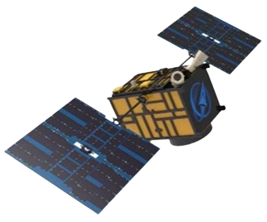
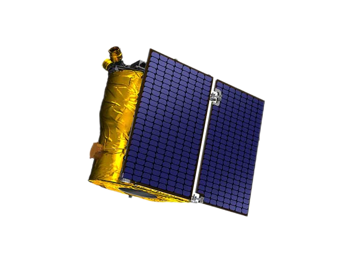
JL1 Satellite Services


The technical index and function mode in terms of satellites research are taking the leading position in the world. Various satellite services such as imagery data, remote sensing application and satellite systems form a complete satellite service network of JL1 constellation
CHANGGUANG SATELLITE SERVICES INTRODUCE
Satellites Data
Push Broom Scanning
Satellite Image Video
Night Time Data
Multispectral Image Data
Stereo Data
Inertial Space Data
Satellite Remote Sensing
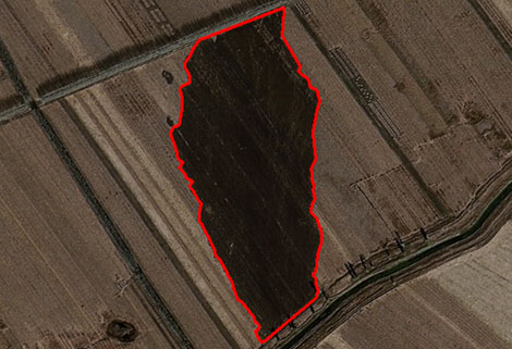
Satellite Remote Sensing In Agriculture
Satellite Remote Sensing In Forestry
Satellite Remote Sensing In Environment
Satellite Remote Sensing In Change Monitoring
Satellite Remote Sensing In Greenbelt
Satellite Remote Sensing In Insurance
Satellite Ground Systems
Image Processing System
Data Management System
Constellation Mission Planning System
Emergency Access And Service Equipment Product
Customized Satellite Ground Systems
HIGH-PERFORMANCE OF CHANGGUANG SATELLITE SERVICES
HIGH TIME RESOLUTION
JL1 satellites can visit any place in the world 23 to 25 times a day, also with the ability to update a global map twice a year and a national map 6 times a year.
HIGH SPATIAL RESOLUTION
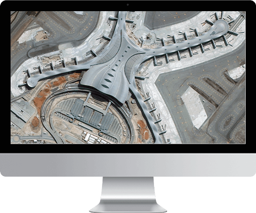
The best panchromatic resolution of JL1 satellites can be better than 0.5m. Other panchromatic resolutions such as 0.7m, and 1m are also available in the archived data or programming data.
FAST DEMAND RESPONSE AND STRONG SERVICE ABILITY
We have independently researched and developed the domestic satellite ground emergency service system based on the satellite ground integration design, which has the obvious advantages of fast demand response and strong emergency capacity. We will strive to build a world-class rapid response capability of satellite remote sensing for emergencies.
Chang GuangSatellite Technology Co., Ltd. is a satellite data companies, we provide satellite communication service, satellite services, aerial satellite services, satellite communication service, etc. For more information about types of satellite data products, please feel free to contact us!
There are many satellite service providers, but we are one of the best choices for you.
Send product request
Other supplier products
 |
JL1 Satellite Manufacturing Product | Based on "the integration of satellite-borne" and other core technologies, CGSTL has set up the commercial business dealing with the development an... |
 |
PUSH BROOM SCANNING SERVICE | The massive imagery archieved data and task programming data that cover all over the world captured by JL1constellation. Great view and great detai... |
 |
STEREO SATELLITE DATA | The data of SP or GF satellites of JL1 constellection can be used as stereoscopic mapping to produce DSM results with resolution better than 1m. ... |
 |
SATELLITE PRODUCTS | SATELLITE PRODUCTS Jilin 1 satelliteconstellation is the core project of CGSTL. It is composed of 138 high-performance optical remote sensing sate... |
 |
REMOTE SENSING IN ENVIRONMENT | remote sensing in environmentis a general term for monitoring, evaluating and forecasting the dynamic changes of the natural and social environment... |
Same products
 |
PHOTOGRAMMETRY REMOTE SENSING | Seller: Chang Guang Satellite Technology Co., Ltd. | Photogrammetry remote sensingis to obtain reliable information about the earth, its environment a... |
 |
MARINE REMOTE SENSING | Seller: Chang Guang Satellite Technology Co., Ltd. | MARINE REMOTE SENSING Ocean colour remote sensingrefers to remote sensing that takes the ocean a... |
 |
NIGHT SATELLITE IMAGE | Seller: Chang Guang Satellite Technology Co., Ltd. | The SP and GF03C satellites of JL1 constellection can conduct fast shooting with high-resolutions... |
 |
MULTISPECTRAL IMAGES IN REMOTE SENSING | Seller: Chang Guang Satellite Technology Co., Ltd. | Multispectral remote sensing refers to the multispectral data remote sensingtechnology that divid... |
 |
MULTI SPECTRAL IMAGERY | Seller: Chang Guang Satellite Technology Co., Ltd. | The GP satellites of JL1 constellection have 26 spectral channels, covering optical remote sensin... |

