
MULTISPECTRAL IMAGES IN REMOTE SENSING


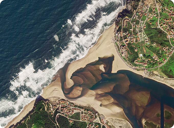
Multispectral remote sensing refers to the multispectral data remote sensingtechnology that divides the electromagnetic wave radiated by ground objects into several narrow spectral bands and obtains the information of the same target in different bands at the same time by photographing or scanning.
Chang Guang Satellite Technology Co., Ltd. is a satellite company, we provide satellite china, multispectral and hyperspectral remote sensing, multispectral remote sensing, hyperspectral and multispectral remote sensing, multi spectral remote sensing, satellite data products,etc. Formore informationabout multispectral remote sensing applications, please feel free to contact us!
Send product request
Other supplier products
 |
SATELLITE IMAGE PROCESSING TECHNIQUES | SATELLITE IMAGE PROCESSING TECHNIQUES SATELLITE IMAGE ACQUISITION SYSTEM SATELLITE IMAGES FOR IMAGE PROCESSINGFEATURES 1 Satellite image pr... |
 |
REMOTE SENSING IN FORESTRY | Applications of remote sensing in forestry Remote sensing in forestryis a technology that uses the inherent characteristics of electromagnetic wav... |
 |
SATELLITE IMAGE VIDEO | Satellite Image Video The SP, GF03C and MF satellites of JL1 constellection can gaze at a single target point for 120 seconds at most to record ... |
 |
Services | Bioanalytical Service Bioanalytical Service for Small Molecule Drugs and Metabolites, Large Molecules – Peptides and Proteins, etc. LCMSMS Q... |
 |
PUSH BROOM SCANNING SERVICE | The massive imagery archieved data and task programming data that cover all over the world captured by JL1constellation. Great view and great detai... |
Same products
 |
PHOTOGRAMMETRY REMOTE SENSING | Seller: Chang Guang Satellite Technology Co., Ltd. | Photogrammetry remote sensingis to obtain reliable information about the earth, its environment a... |
 |
MARINE REMOTE SENSING | Seller: Chang Guang Satellite Technology Co., Ltd. | MARINE REMOTE SENSING Ocean colour remote sensingrefers to remote sensing that takes the ocean a... |
 |
NIGHT SATELLITE IMAGE | Seller: Chang Guang Satellite Technology Co., Ltd. | The SP and GF03C satellites of JL1 constellection can conduct fast shooting with high-resolutions... |
|
|
MULTISPECTRAL IMAGES IN REMOTE SENSING | Seller: Chang Guang Satellite Technology Co., Ltd. | Multispectral remote sensing refers to the multispectral data remote sensingtechnology that divid... |
 |
MULTI SPECTRAL IMAGERY | Seller: Chang Guang Satellite Technology Co., Ltd. | The GP satellites of JL1 constellection have 26 spectral channels, covering optical remote sensin... |
