

SATELLITE GROUND SYSTEMS


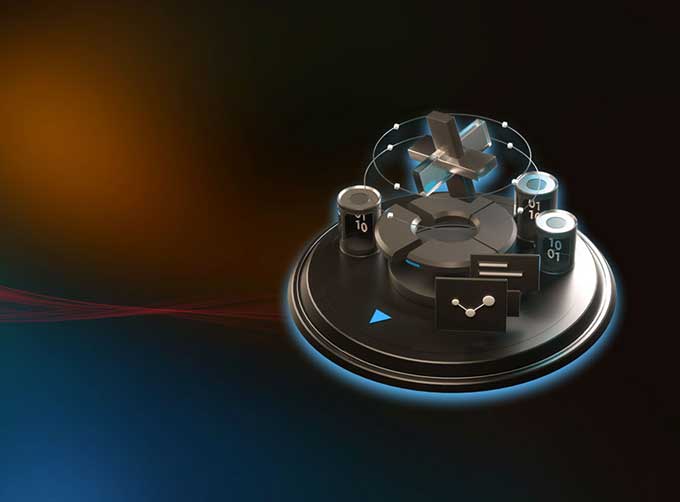
The mission of the ground satellitesystem is to track, measure and control the earth resources satellite, implement functional management, and receive, record and process the image data sent back by the satellite.
Satellite Image Processing Techniques
Satellite Data SystemManagement
Satellite Mission Planning
Emergency Satellite Communications Product
Customized Satellite Ground Systems
FEATURES OF SATELLITE GROUND SYSTEMS
Connecting satellites and spacecraft to earth.
If you want to know more details of ground station in satellite communication, please contact us.
CGSTL (ChangguangSatellite Technology Co., Ltd) is the first commercial remote sensing satellite supplier in China. Now, CGSTL has set up a commercial business dealing with the development and operation of commercial satellites as well as remote sensing information processing all in one.
Send product request
Other supplier products
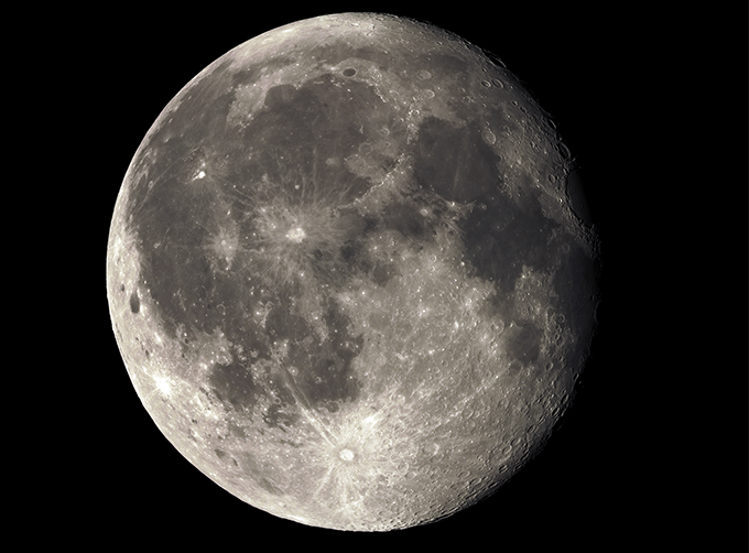 |
LUNAR SATELLITE IMAGES | Jilin 1satellites can not only capture the images of the earth, but they can also turn the cameras to photograph space objects, such as the space s... |
 |
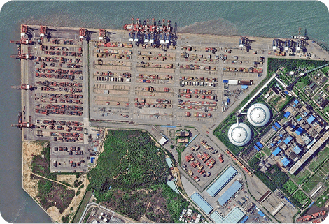
PHOTOGRAMMETRY REMOTE SENSING | Photogrammetry remote sensingis to obtain reliable information about the earth, its environment and other natural objects and processes by using sa... |
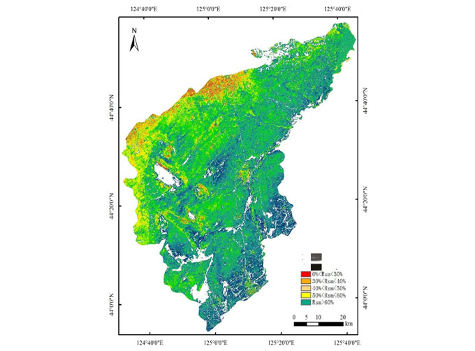 |
SATELLITE REMOTE SENSING IN AGRICULTURE | SATELLITE REMOTE SENSING IN AGRICULTURE Agricultural remote sensing refers to the comprehensive technology of agricultural applications such as us... |
 |
Satellites Data Service | At present, JL1 constellation has 72 on-orbit satellites in space and more than 5,000,000 square kilometers of new shooting area in the world are a... |
 |
Services | Bioanalytical Service Bioanalytical Service for Small Molecule Drugs and Metabolites, Large Molecules – Peptides and Proteins, etc. LCMSMS Q... |
Same products
|
|
PHOTOGRAMMETRY REMOTE SENSING | Seller: Chang Guang Satellite Technology Co., Ltd. | Photogrammetry remote sensingis to obtain reliable information about the earth, its environment a... |
 |
MARINE REMOTE SENSING | Seller: Chang Guang Satellite Technology Co., Ltd. | MARINE REMOTE SENSING Ocean colour remote sensingrefers to remote sensing that takes the ocean a... |
 |
NIGHT SATELLITE IMAGE | Seller: Chang Guang Satellite Technology Co., Ltd. | The SP and GF03C satellites of JL1 constellection can conduct fast shooting with high-resolutions... |
 |
MULTISPECTRAL IMAGES IN REMOTE SENSING | Seller: Chang Guang Satellite Technology Co., Ltd. | Multispectral remote sensing refers to the multispectral data remote sensingtechnology that divid... |
 |
MULTI SPECTRAL IMAGERY | Seller: Chang Guang Satellite Technology Co., Ltd. | The GP satellites of JL1 constellection have 26 spectral channels, covering optical remote sensin... |
