
SATELLITE IMAGE PROCESSING TECHNIQUES

SATELLITE IMAGE PROCESSING TECHNIQUES
SATELLITE IMAGE ACQUISITION SYSTEM
SATELLITE IMAGES FOR IMAGE PROCESSINGFEATURES
1
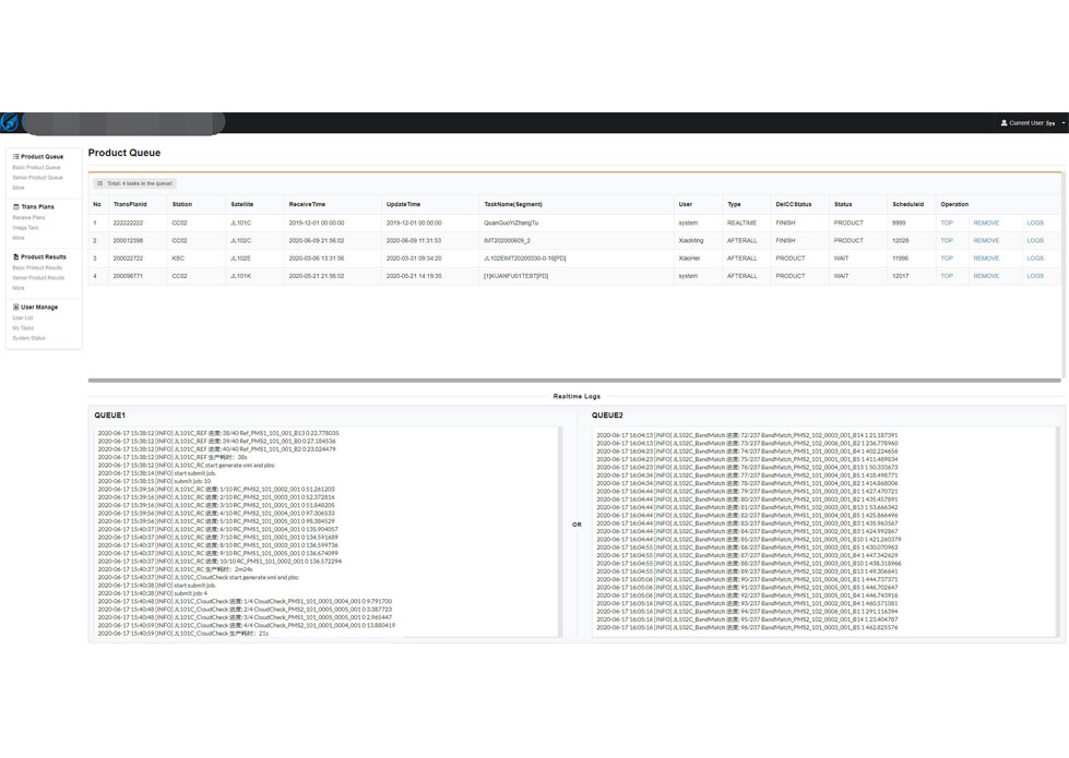
Satellite image processingsystem is the core of preprocessing of satellite imagesafter landing.
2
The system decrypts and decompresses the received original code stream data, completes the analysis and processing of auxiliary data, and then catalogues the data.
If you want to know more details of image processing of satellite images, please visit our website.
CGSTL (ChangguangSatellite Technology Co., Ltd) is the first commercial remote sensing satellitesupplier in China. Now, CGSTL has set up a commercial business dealing with the development and operation of commercial satellites as well as remote sensing information processing all in one.
在线联系供应商
Other supplier products
 |
REMOTE SENSING IN ENVIRONMENT | Satellite Environmental Monitoring Remote sensing in environmentis a general term for monitoring, evaluating and forecasting the dynamic changes... |
 |
MARINE REMOTE SENSING | Oceanographic Applications of Remote Sensing Ocean color remote sensing refers to remote sensing that takes the ocean and coastal zone as the moni... |
 |
NIGHT SATELLITE IMAGE | The SP and GF03C satellites of JL1 constellection can conduct fast shooting with high-resolutions and multispectrums at night, which can reflect hu... |
 |
CUBESAT PLATFORM | Cubesat for Sale The cube satellite platform can provide carrying services for the user's payload. 12U Cubesat Platform Non-standard 6U Cubesat... |
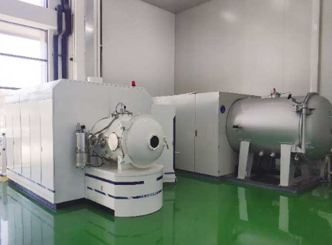 |
SATELLITE TESTING SERVICE | A key test satelliteprocedure in qualifying a satellite for launch. Component-level Thermal-vacuum Test Space Camera / Satellite Vacuum Heat E... |
Same products
 |
PHOTOGRAMMETRY REMOTE SENSING | 卖方: Chang Guang Satellite Technology Co., Ltd. | Photogrammetry remote sensingis to obtain reliable information about the earth, its environment a... |
 |
MARINE REMOTE SENSING | 卖方: Chang Guang Satellite Technology Co., Ltd. | MARINE REMOTE SENSING Ocean colour remote sensingrefers to remote sensing that takes the ocean a... |
|
|
NIGHT SATELLITE IMAGE | 卖方: Chang Guang Satellite Technology Co., Ltd. | The SP and GF03C satellites of JL1 constellection can conduct fast shooting with high-resolutions... |
 |
MULTISPECTRAL IMAGES IN REMOTE SENSING | 卖方: Chang Guang Satellite Technology Co., Ltd. | Multispectral remote sensing refers to the multispectral data remote sensingtechnology that divid... |
 |
MULTI SPECTRAL IMAGERY | 卖方: Chang Guang Satellite Technology Co., Ltd. | The GP satellites of JL1 constellection have 26 spectral channels, covering optical remote sensin... |
